The Story of Stovely, B.C and Neighborhood ~ 1862-1990
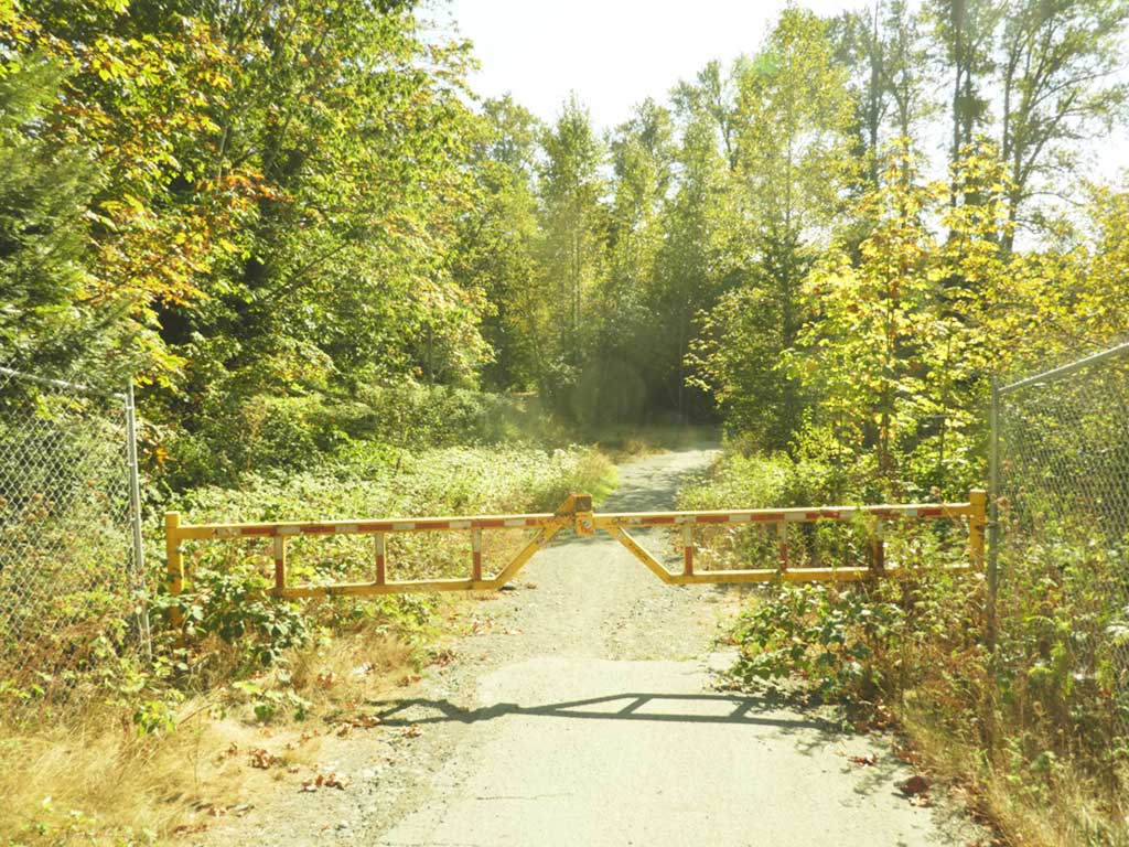
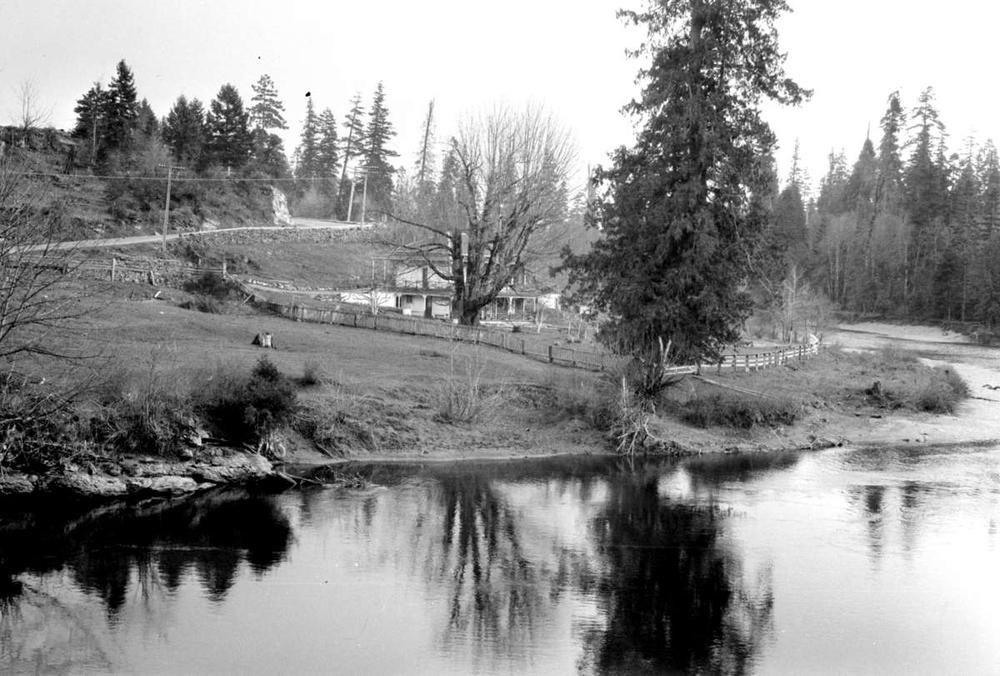
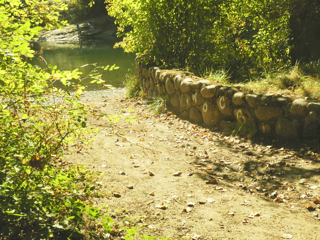
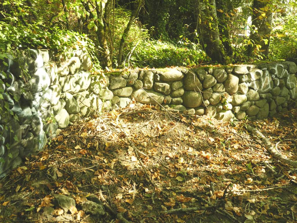
Today, it stands as an unmarked, desolate gravel expanse enclosed by a chain-link fence and a formidable yellow gate. Beyond these barriers, nature’s embrace slowly reclaims the land. Hundreds of passersby navigate this scene daily, oblivious to the rich history that once thrived here for nearly a century—a bustling gateway to an innovative riverside community, now vanished without a trace.
Compiled by Roger Prior 2022
The SneNeyMous People
For millennia, the SneNeyMous indigenous community have thrived in this region, nestled at the confluence of the Nanaimo River and the surrounding area. Their resilient existence has been sustained through the centuries by harnessing the rich resources of the land and waters. They have skillfully harvested the bountiful salmon runs within the river’s estuary, gathered nourishment from the abundance of shellfish, and ventured into the inland forests and plains for successful hunts.
They were originally based in two principal villages—one on the northern shores of the harbour, and the other situated on the southern bank of the river near the estuary. Present-day Cedar, along with the specific locality of Stovely, shares proximity with the Number 4 Reserve, a testament to the deep-rooted history of the SneNeyMous people. Beyond their main settlements, the SneNeyMous established seasonal camps at locations that now bear names like Duke Point, Mudge Island, and the beach south of Dodd’s Narrows.
The First Colonists
In 1849, the first colonists arrived in the vicinity of what would later become Nanaimo, coming from England to the Hudson’s Bay Company outpost. They were followed in 1854 by another group of miners, labourers, and their families, brought to the colony by the HBC with the intent of developing their holdings.
Between 1849 and 1862, there were 14 voyages transporting settlers to Fort Victoria. After the entire area was officially surveyed in 1858, and land became available for preemption, some members of the small community seized the opportunity to explore beyond the established settlement.
In April 1862, Robert Beecham and Richard Richardson, early miners in Nanaimo, embarked on a canoe journey through the Nanaimo River estuary and upstream for several miles. Beecham staked one claim near the Native Reserve, situated near the river’s mouth and established as part of the Douglas Treaties of 1854. Richardson, on the other hand, staked two claims further upriver, both on the eastern shore. The first was located near a gravel beach, which is now the site of the Cedar Bridge, and the second was farther up the river, also on the eastern side, in an area that would later be known as Haslam Creek.
According to the colony’s settlement plan, which was formalized after the survey, land was to be made available in 160-acre parcels (equivalent to one-quarter section) for $1 per acre. To secure their claims, applicants were required to improve the land by fencing, constructing buildings, implementing drainage systems, and clearing along road allowances.
Richardson did not pursue his claims and eventually sold them to other settlers. In August 1874, he sold the 55 acres from his first claim to James Stove, a fellow miner from Nanaimo, at a rate of $1 per acre.
Between 1863 and 1864, after the land had been surveyed and preemption grants were issued, several families established their homes in the area surrounding the river crossing.
The earliest settlers in the region were Charles York and James Gordon, who arrived in 1858 after seeking their fortunes in the northern goldfields. They jointly acquired land around what is now York Lake and initially focused on cattle ranching and cultivating a market garden. Eventually, they went their separate ways, with Gordon securing a sizable property near the estuary.

The Bridges
Until the construction of the first bridge, early settlers faced the challenge of navigating the river by canoe and landing near what is now the Duke Point overpass. It’s possible that a rudimentary overland trail from Chase River existed as an alternative route.
Transporting their goods upstream required hauling them up the steep riverbank using sleds pulled by heavy horses or oxen. They would arrive at the track that would later become Cedar Road, approximately where the United Church stands today.
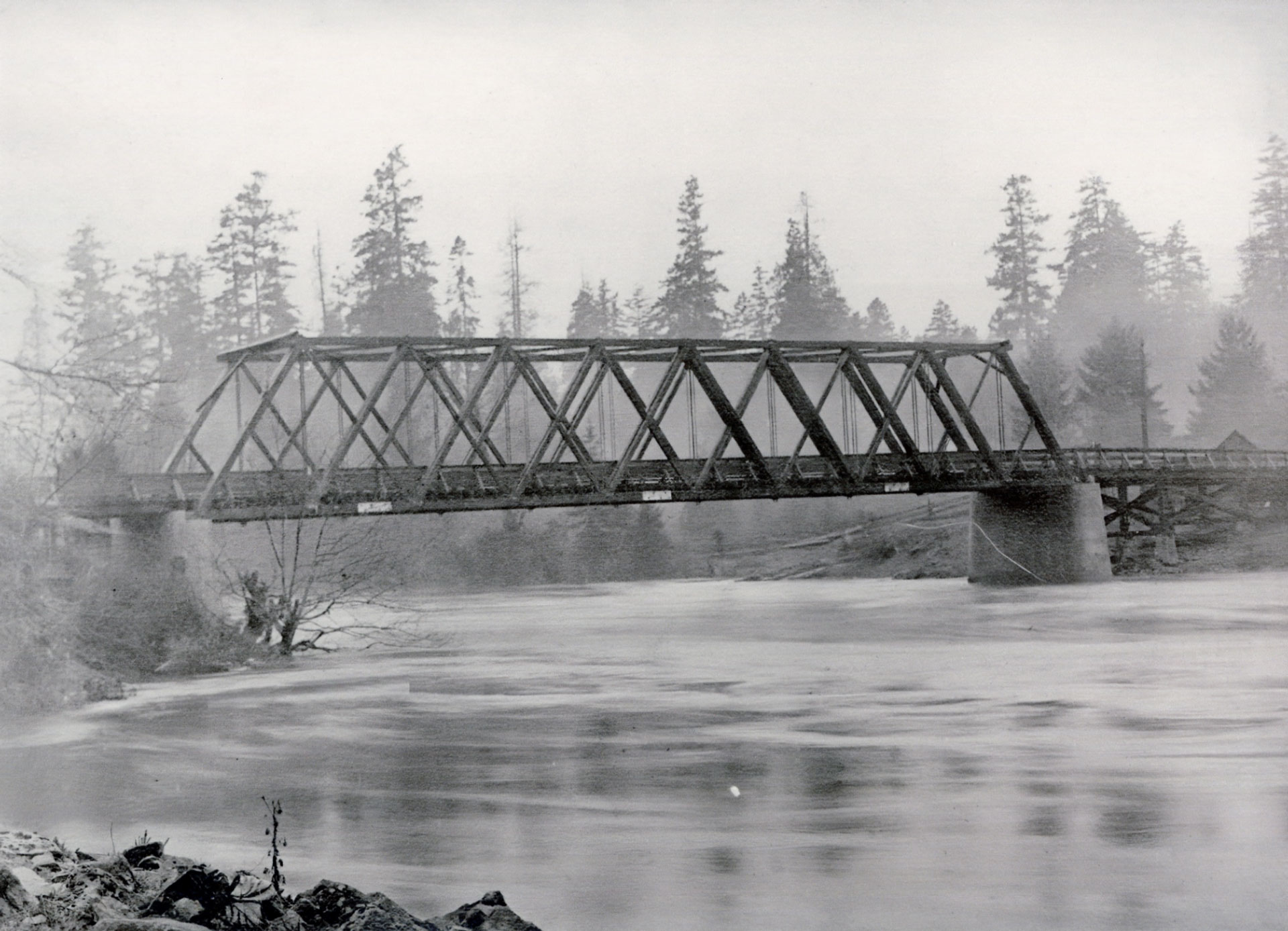
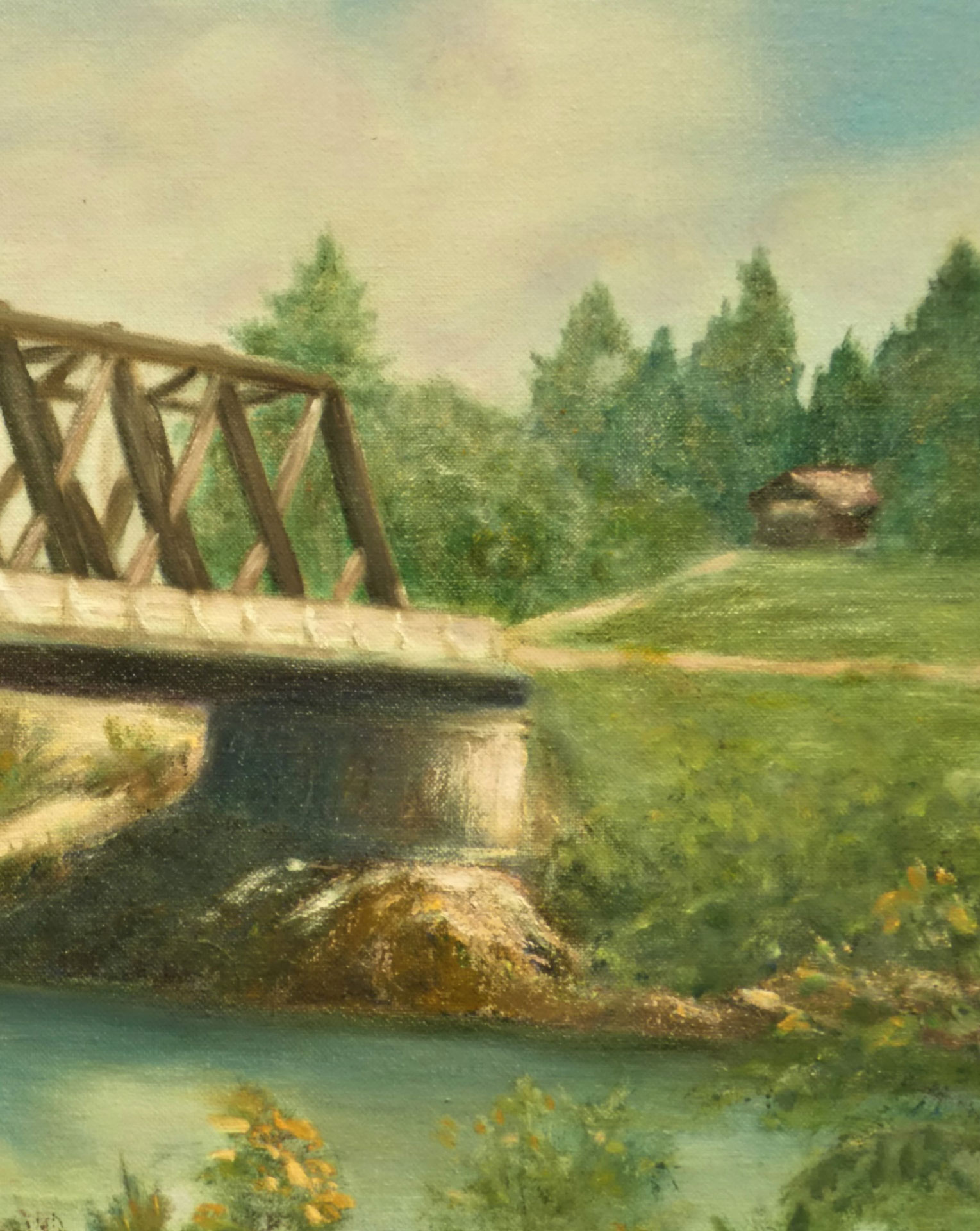
Pressure from local settlers led to the construction of the first bridge over the river in 1865. From surviving photographs, it appears that this bridge was made of logs spanning the river with an A-frame design. It featured a planked deck and was anchored on both sides by stacked timber baulks, with support provided by loose rock pilings and log cribbing. Improvements were also made to the north-side road approach.
Regrettably, the builders didn’t account for the periodic high winter flood levels of the river, and the bridge lasted only two years before being washed away. Despite fervent appeals by locals to the authorities in Victoria, it took another nine years for a replacement to be constructed. In the interim, local settlers had to resort to ferrying themselves and their goods across the river using canoes and barges. The Nanaimo River experienced almost annual flooding, often spilling several feet above its banks, a pattern that continues to this day.
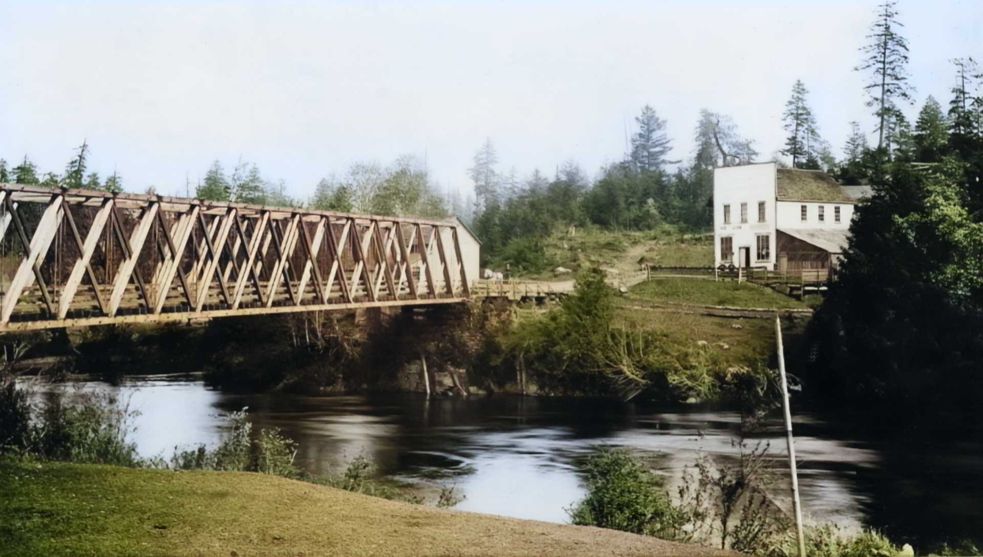
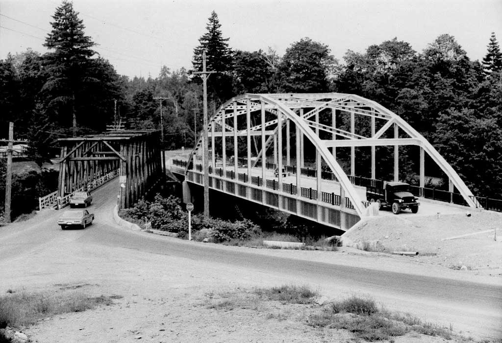
In 1874-75, a second bridge was completed at the same location. The contractor, Daniel Fowler Adams, originally from New Brunswick, was responsible for several early bridges on Vancouver Island, including the first bridge over the Gorge in Victoria. The Cedar Road bridge he built was 167 feet long and 12 feet wide, consisting of 4-inch-thick planking, supported by two arch beams made of steamed laminated lumber. It featured a lattice truss construction, with concrete pilasters on both sides for support. The total cost in 1874 was $4,500, which is equivalent to $153,000 in 2022.
During this period, the ‘cattle trail’ was completed, connecting Cowichan to Nanaimo. At its northern end, this trail became Cedar Road and was known as the Island Highway for many years, as it was the sole through-road between Nanaimo and Cowichan until the designated Island Highway was constructed further west through south Wellington to Ladysmith.
The southern end of the bridge served as a junction, with one trail heading downstream to the Reserve (later Raines Road), and another road extending southeast to the Gordon farm on the estuary.
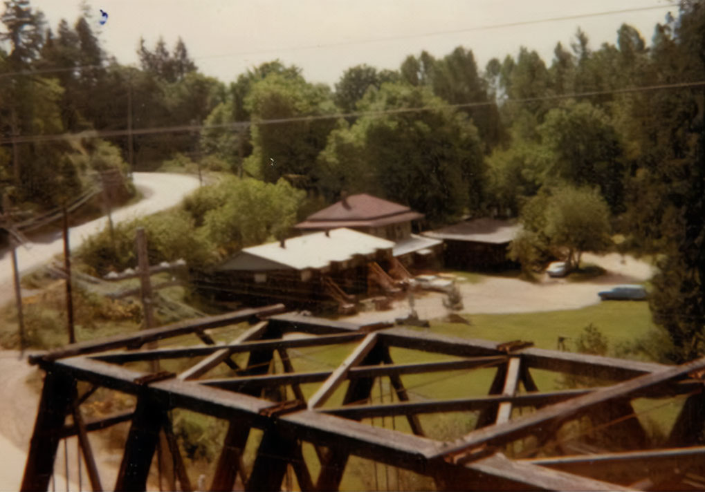
Over time, the bridge underwent four additional reconstructions, occurring in 1889, 1896, and 1932, until the current bridge was built in 1949-50 to facilitate industrial traffic between the Harmac pulp and paper mill on Northumberland Channel and the Assembly Wharf downtown. During this period, the roads at the junction were rerouted, with the new Harmac Road being established, Gordon Road relocated further east, and Cedar Road branching off from the intersection at the south end of the bridge.
James Stove: A Pioneer’s Journey
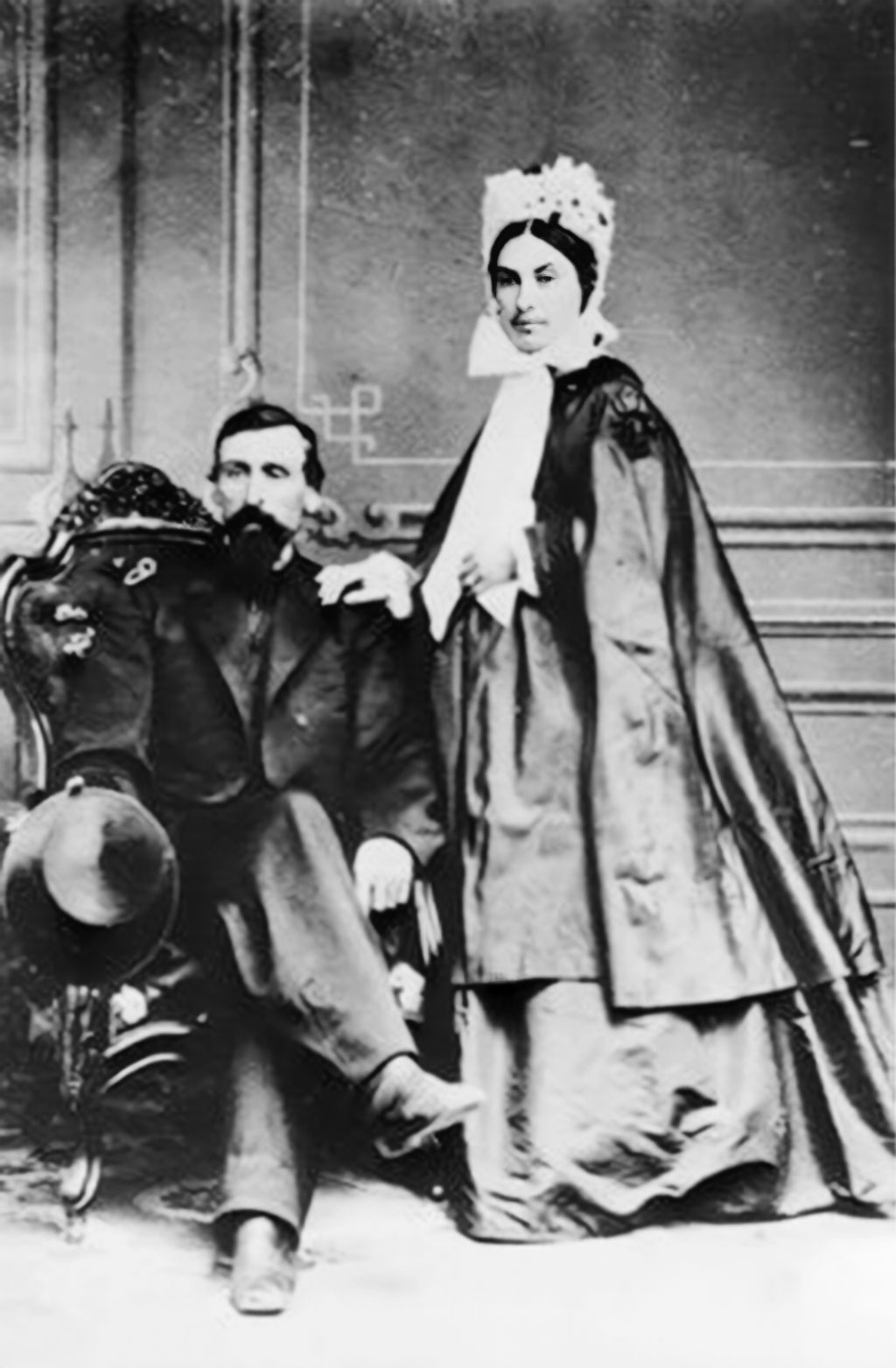
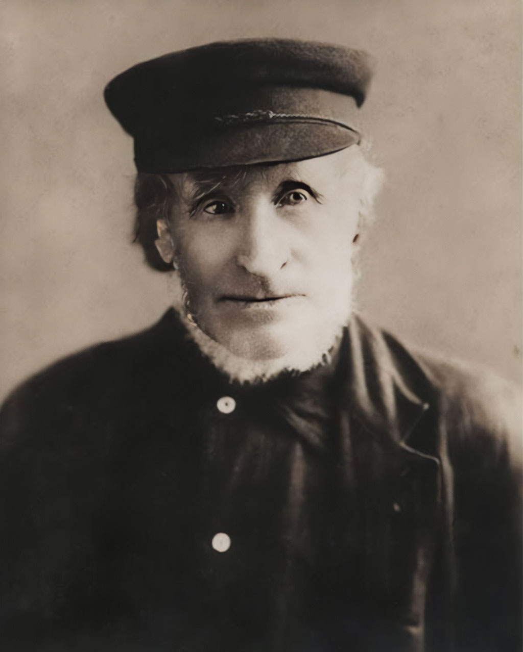
James Stove, born on August 1, 1828, to John and Margaret Stove in the village of Rendall in the Orkney Islands off the north coast of Scotland, faced limited opportunities for advancement in his homeland. At the age of 23, he likely responded to the Hudson’s Bay Company’s recruiters who were promoting their new colony in Canada.
Many other Orkney Islanders had already answered the HBC’s call and sailed for Fort Victoria. Ships carrying passengers from various parts of the United Kingdom made this voyage annually between 1849 and 1862. In late 1850, Stove embarked from London on the HBC vessel “Tory,” a 130-foot sailing barque contracted to bring laborers, miners, and their families to the colony. After a challenging five-month journey around Cape Horn with a resupply stop in Hawaii, the “Tory” finally landed in Victoria in 1851. Stove and his fellow travelers were then dispatched further north on Vancouver Island to Fort Rupert, where they were to work on a prospective coal mine. When that endeavor failed after a few years, Stove and other workers returned to the more established colony of Nanaimo.
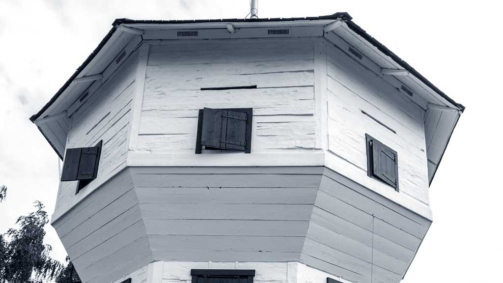
In Nanaimo, Stove initially found employment in the HBC coal mine and contributed to building housing for the settlers. He was part of a crew that erected the HBC’s protective fort, the Bastion, in 1853-54.
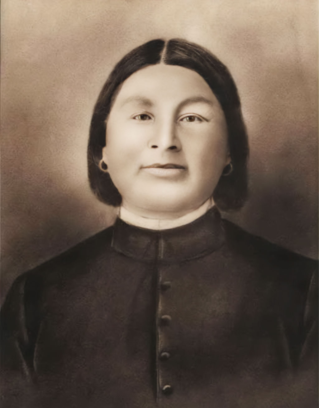
On May 25, 1867, at the age of 39 and after spending 16 years in the colony, James Stove married Margaret Wansaat, a native woman, in the Wesleyan Methodist church on Wallace Street in Nanaimo. Margaret and the children were baptized there as well. At the time, Margaret was 23 years old, and the couple had already lived in Nanaimo for at least seven years, having three children together. Subsequently, they expanded their family, with four more children born at their home by the river in Cedar.
Tragedy struck twenty years later when, on May 3, 1887, two of their sons, John and Robert, were among the 150 miners killed in the Number One Mine disaster. Two other Cedar residents, John and Copley Woobank, also lost their lives. In 1874, when the second bridge was built and James Stove was 46 years old, he purchased the 55 acres of Richardson’s claim along the southeastern bank of the river. The Stove family made the journey from town to their new home in Cedar, traveling six kilometers by wagon along a dirt track through the forest from Chase River, crossing the bridge. Their property stretched as a long strip along the river near the east end of the bridge. James Stove utilized timber from the property to construct a house and other buildings on elevated ground.
The First Cedar School
In the same year, James Stove undertook another significant endeavor. He built the first Cedar school on two acres of his property near the bridge, in the vicinity of what is now Raines Road. The growing number of children in the area warranted the establishment of a local school, and more students would arrive in the coming years.
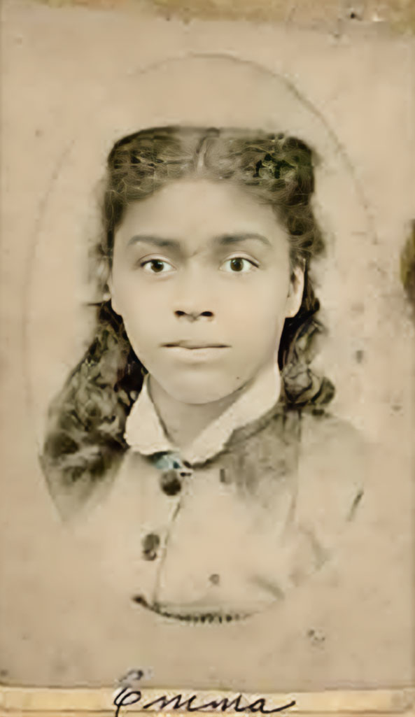
Emily Stark, whose family resided in South Wellington where her father worked as a miner, became the first teacher at the school.
The Cranberry Arms Hotel
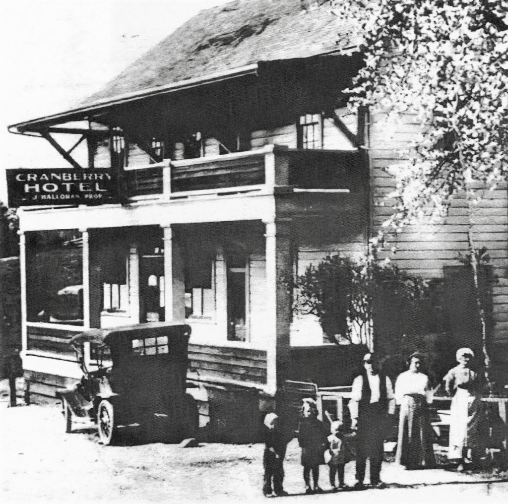
In 1878, Ann and Michael Halloran constructed the Cranberry Arms hotel on property Michael had pre-empted on the hill above the bridge along Cedar Road.
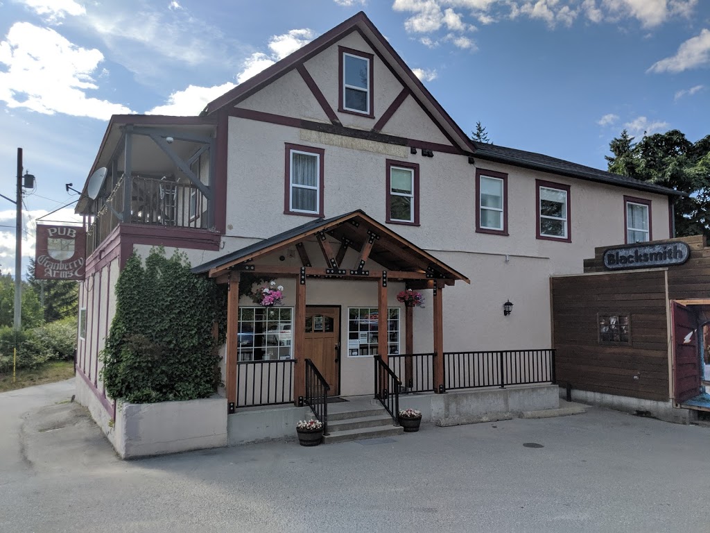
It served as a way station for stagecoaches and travelers between Nanaimo and Cowichan. Remarkably, the Cranberry Arms remains a local fixture today, possibly the only building from its era still standing.
The Taylors and the Stovely Post Office
George and Harriett Taylor, along with their daughter Jane and sons Dexter and William, arrived from England in the early 1880s. They purchased a five-acre corner block of land from James Stove, which was adjacent to the river and on the trail leading from the new bridge. On this land, they built a house that also housed a general store. In 1890, it was designated as the North Cedar post office.
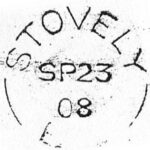
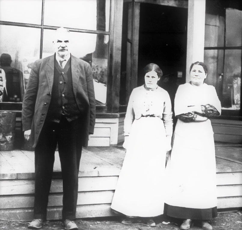
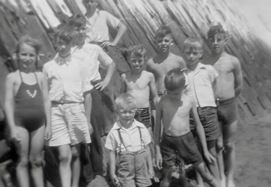
Photo: Jack Ruckledge collection
Mr. Taylor named the post office Stovely, in recognition of the Stove family. The official Post Office stamp bore the name Stovely, and it appeared on government maps for some time afterward. The post office served residents within approximately a five-kilometer radius, who would gather there to collect their mail and send letters. The next closest post office was South Cedar, established two years earlier in 1888, and managed by Mr. Hill from his house at Hill Road, located 10 kilometers south.
Mrs. Taylor became proficient in Chinook, the trade language with the native people, and served as a midwife, delivering many local babies. During this time, all babies were born at home, except in rare emergencies, as the nearest hospital was over an hour away in Nanaimo. Mrs. Taylor likely had a designated “lying-in” facility in her home since there were no resident medical doctors in Cedar at the time.
The store and post office were eventually taken over by the Jim McKinnell family, who also provided accommodations for boarders. After some years, they relocated further south on Cedar Road to a new house opposite the Anglican church. The Stovely designation ceased to be used when the Post Office was moved about a mile further south to a more central location on Cedar Road at the corner of Holden Corso.
The house continued to operate as a boarding house and lodging for travelers, managed for a time by Mrs. Cheatwood. She was related to the Wilkinson family, who lived on the north side of the river, and her family operated the Palace Hotel in Nanaimo for a period.
Second Cedar School and The Red Lion Brewery
In 1886, the first Cedar school beside Gordon Road and the Stove property was phased out and replaced by a second, larger Cedar school, often referred to as the “white school.” It was located beside the Taylor property on the hillside above the river, just below Cedar Road and across from the Cranberry Arms hotel.
This school, situated on a one-acre property, included a playground that extended from Cedar Road down to the river. It operated for eight years until 1894 when it was replaced by a third school further up the hill, above the Cranberry Arms Hotel.
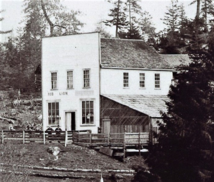
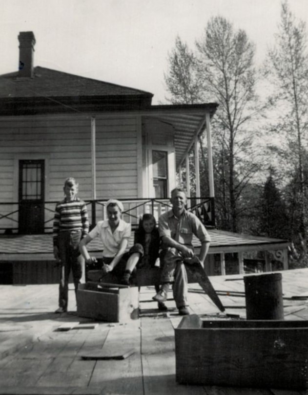
Walter Meyer zu Erpen photo
Also located on the Taylor property was a two-story building originally constructed by James Stove. In 1886, Thomas Preece and John James took over the building and formed a partnership to establish the Red Lion Brewery. The brewery, named after the famous brewery on the south bank of the Thames in London, featured brewing equipment capable of producing 300 gallons daily. It used water piped from the river and supplied Nanaimo hotels with beer in barrels. At the time, it was the third brewery operating in Nanaimo.
Unfortunately, in December 1887, John James disappeared with about $600, the entire company’s funds, shortly after collecting payments from the hotels they supplied. Thomas Preece continued to run the brewery as best he could, but in 1889, Nanaimo brewmaster Walter Reifel bought a stake in the Red Lion Brewery and was later joined by another brewmaster, John Marwick.
Thomas Preece’s association with the Red Lion eventually ended. In 1892, the partners closed the Red Lion Brewery and consolidated their operations at the Union Brewery in Nanaimo. Thomas Preece is believed to have returned to Victoria, where he was appointed foreman of civic waterworks and contributed to expanding water services throughout the city.
In 1919, the Red Lion Brewery building was demolished, and the lumber was repurposed by neighbouring dairyman Herb Armishaw for other structures on his property across the river. Between 1910 and 1940, as the Stovely property changed hands multiple times, the boarding house continued to operate based on the limited surviving records.
The San Salvador Resort and Campground
Around 1945, retired ship’s captain Otto Alcorn and his wife Theodora, along with their children Garry, Consuela (Connie), and Arden, acquired the property. They transformed it into the San Salvador Resort and campground. The old house was replaced with two motel-style buildings featuring self-contained suites. The Alcorn family resided in the old schoolhouse on the property. The San Salvador provided accommodations for workers’ families during the construction of Harmac and also welcomed holidaymakers and travelers.
Captain Alcorn, originally from the Maritimes, had spent a significant portion of his seafaring career along the eastern seaboard, including the Caribbean and Central America. This background may have inspired the name “San Salvador” for the resort, possibly in reference to the famous Caribbean island. Captain Alcorn also served on several Merchant Marine ships in the Atlantic during World War II. The resort and campground became the Alcorns’ retirement project, and they became active members of the Cedar and Nanaimo communities.
Captain Alcorn passed away in 1972, and his widow, Theodora, continued to manage the San Salvador for another nine years until it was sold in 1981 to the Alder family from Calgary. Fred Alder made further improvements to the property and managed the rental units and campground.
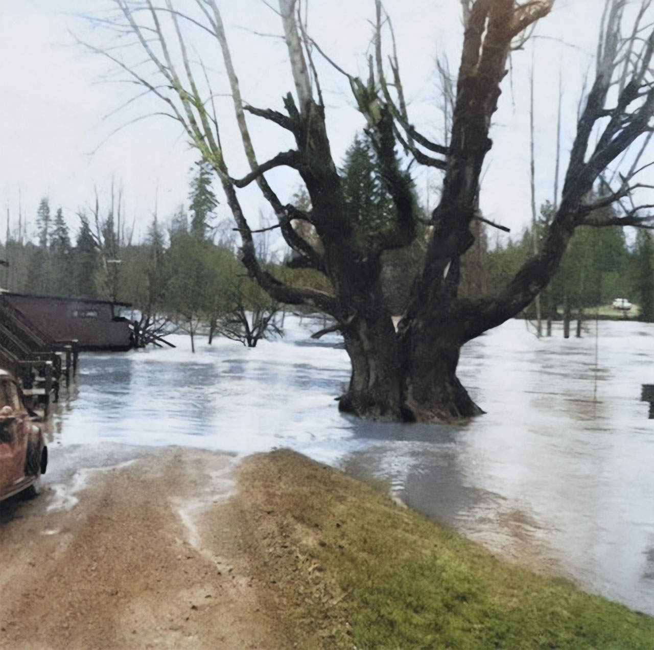
Unfortunately, several significant floods in the 1980s and early 1990s made it increasingly challenging to sustain operations. Eventually, in 1997, the Province of BC reclaimed the entire property and constructed the new Duke Point highway overpass on the former campground site.
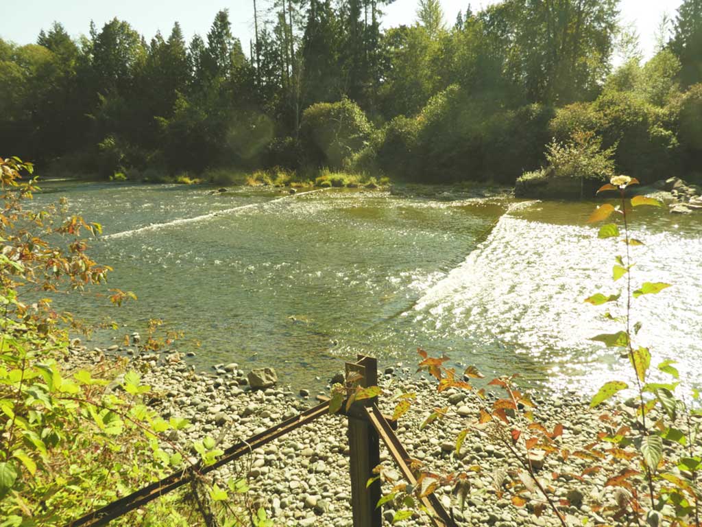
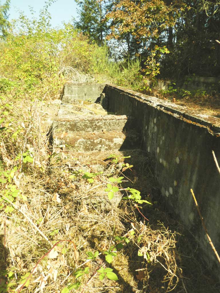
Since then, all traces of buildings and habitation have been removed. The property is now used primarily for maintaining an automated fish counter at the tidal limit by Fish and Wildlife and for periodic training exercises on the river by Cedar Fire and Rescue.
Charles York and James Gordon: Pioneers and Homesteaders
In 1862, two pioneers, Charles York and James Gordon, arrived in the Cedar area, each with unique journeys that led them to this picturesque location. Both had initially come to North America from England in the 1840s with dreams of homesteading. However, their paths converged during the gold rush of 1850, where they met and experienced some degree of success.
In 1863, Charles York and James Gordon, as partners, laid claim to 160 acres of land on the eastern side of the hill overlooking the river. This property included a small lake that would later be known as York Lake. Gordon, in collaboration with two other partners, also claimed an additional 320 acres east of York’s land. Subsequently, Charles York secured an additional 160 acres adjacent to his initial claim, making him the largest landholder in the area. His vast property stretched approximately 1.7 kilometers from the ridge overlooking the river to the present-day location of the Wheatsheaf Hotel. During his lifetime, Charles York sold smaller homestead parcels along Cedar Road to individual settlers. In 1890, he generously donated 1.3 acres of land on Cedar Road for the construction of St. Phillip’s Anglican Church, a place of worship that was built by local volunteers and consecrated the following year.
James Gordon later sold his interest in his properties and relocated to another sizable claim at the mouth of the river. There, he established a prosperous dairy farm. The route of Gordon Road, which runs from the Cedar Bridge to his farm, has undergone several relocations over time and crosses the SneNeyMous Reserve.
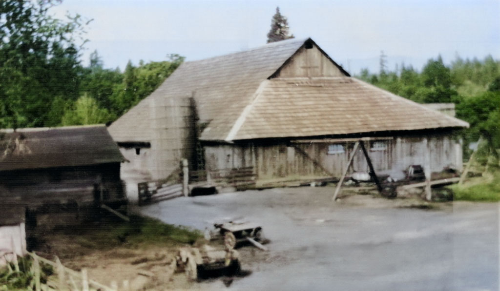
Charles York cultivated the fertile pastureland around York Lake and successfully grew various fruits and vegetables, with a particular emphasis on potatoes, which he produced in large quantities. These crops were sold locally and in Nanaimo. On his property, York erected a house and various outbuildings, including a substantial barn. The trail that traversed his land from the river landing area became known as Cedar Road.
In 1869, Charles York entered into a common-law marriage with a Native woman named Sarah, also known as Cecelia, about whom little is known. Together, they had six children: Samuel (1870), Westley (1872), Nelson (1874), Amos (1876), May (1878), and William (1880).
Tragedy struck in 1882 when Sarah passed away, and Charles York followed her ten years later, in 1892. Both Charles and Sarah are interred in the Nanaimo Cemetery. Following Charles’s passing, the estate was divided among their children and subdivided. Samuel, their eldest son, constructed a substantial house at the top of the hill on York Road. When Samuel married Martha Jane Lees in 1902, their wedding ceremony took place in the newly constructed St. Phillip’s Anglican church on Cedar Road, built on land donated by Charles York. Additionally, an acreage on what is now Holden Corso Road was dedicated in 1922 for the fourth Cedar School, which would eventually become the Cedar Heritage Centre.
The Fiddicks: A Family of Settlers

Samuel Fiddick hailed from a family of tin miners in Cornwall, England. After trying his luck in gold mining in California and the Cariboo, he arrived in Nanaimo in 1862. In 1863, he married Elizabeth Grandam in Nanaimo, and the couple went on to have ten children: Adoris (1864), Charles (1865), Alice (1868), Samuel (1871), Maud (1874), Christopher (1878), Richard (1880), and Harry (1882).
In 1872, Samuel and his family preempted 250 acres on the north side of the river, where they built a home just above the canoe landing, situated at the current location of the Duke Point highway’s river crossing. They engaged in farming on this land until at least 1886 when they sold it and returned to Nanaimo. In the city, they constructed the Occidental Hotel on Fitzwilliam Street to capitalize on the opening of the E&N Railway, as the Nanaimo station was conveniently located nearby.
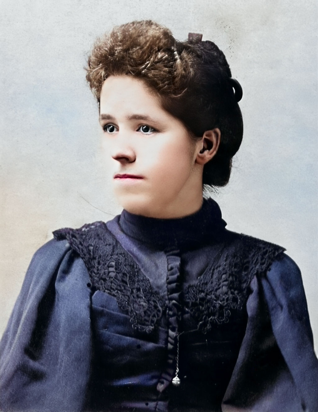
The family’s eldest son, Charles, worked in various capacities as a logger, farmer, and contractor in Cedar, including managing a farm on Thatcher Road. In 1896, he married Anna Leighton in Vancouver. Anna had arrived in Nanaimo in 1892 and resided with the Hemer family while teaching at the second Cedar School in Stovely.
Four of Charles and Anna’s five children were born at their farm on Thatcher Road, which now houses the Eaglequest Golf Course. Around 1903, the family acquired 120 acres at Cedar By The Sea and constructed a house on the eastern end of what would later become Barnes Road. Charles and Anna actively participated in community life, serving on the school committee and contributing to St. Phillip’s church.
The Raines Brothers
In 1888, brothers Walter and George Raines acquired property near the mouth of the river. Walter took over the land originally claimed by Mr. Barton, and George Raines purchased a log cabin on the property that had been constructed in 1872 by Sam York, “Hurricane” Smith, and James Stove. The Raines family resided in this cabin for many years, making additions to accommodate their growing family. Eventually, they took over the adjacent Stove property.
In 1984, descendants of the Raines family generously donated the log cabin to the City of Nanaimo as a classic example of early log construction. The cabin, known for its squared logs, dovetail corners, and nail-free construction, was moved to Bowen Park. It could possibly be the oldest surviving example of an original settler’s home in Nanaimo.
Over the years, George and his family developed the Maple Leaf Dairy on their property.
Armishaw: Dairy Farming Legacy
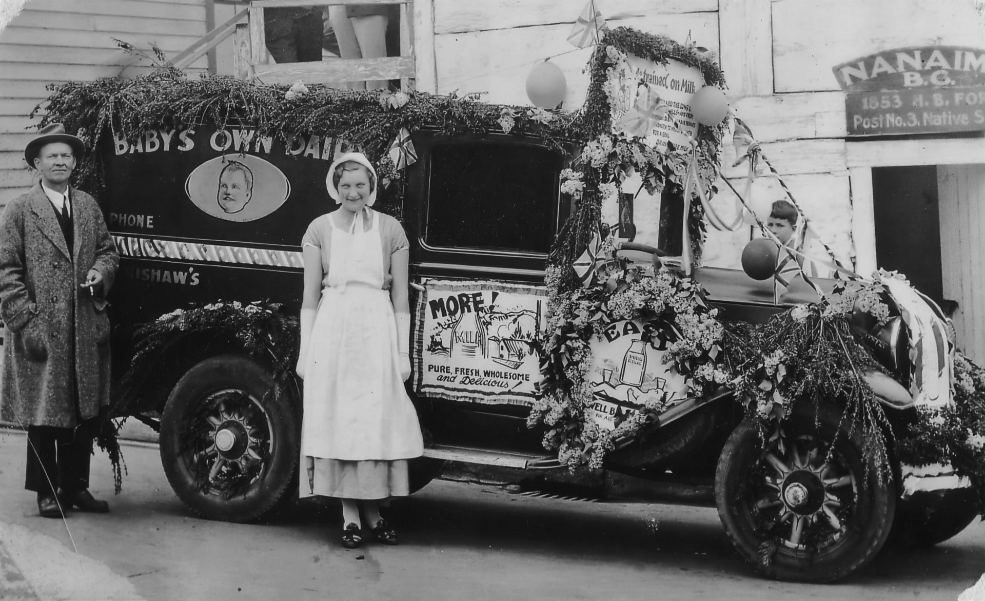
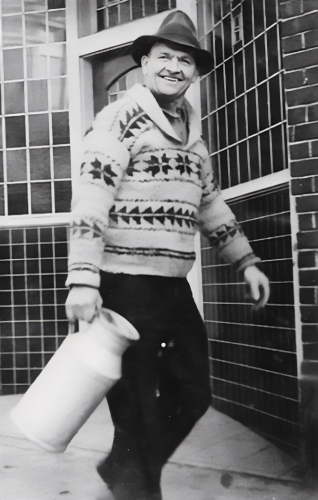
Around 1920, Herb Armishaw acquired 90 acres on the north side of the river, located at the east end of Akenhead Road. This property was directly across the river from Stovely. Herb built a family home and established a dairy farm known as “Baby’s Own Dairy.” The farm supplied milk both locally and in Nanaimo.
Herb also operated a milk processing plant on Albert Street, producing the first pasteurized milk in Nanaimo and serving other dairy farms in the area. In 1995, the Department of Highways expropriated thirteen acres of the original farm on Akenhead Road to construct the Duke Point highway and bridge over the river, resulting in the demolition of all buildings on that part of the land.
Gilchrist: The Hillside Home
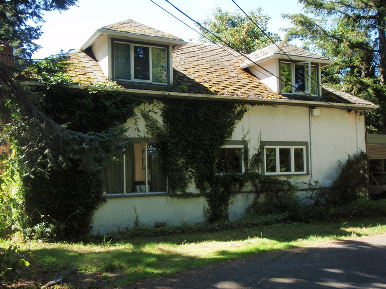
In the early 1950s, Scott and Muriel Gilchrist purchased property on the hill directly above the southern entrance of the Cedar Bridge. They constructed a house from a pre-cut lumber kit transported from Vancouver.
The Gilchrists called this place home until the 1980s when they relocated to a larger property on Raines Road, where their son, Tom, currently resides. The house was subsequently sold and moved to Main Road during the 1990s.
The Reserve Mine: Coal Mining in Cedar
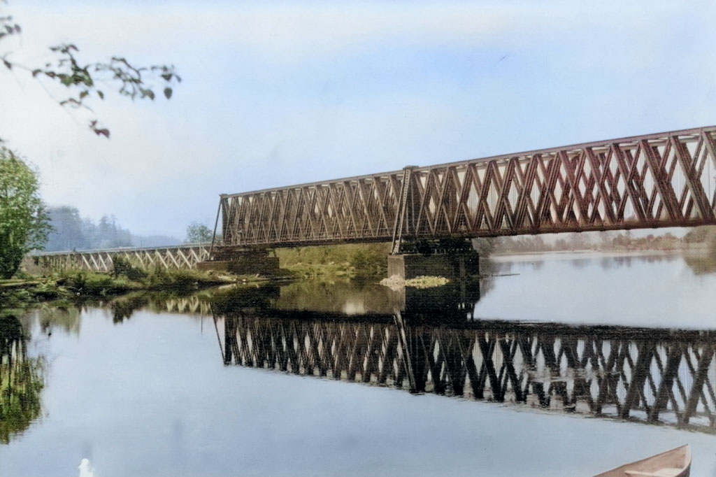
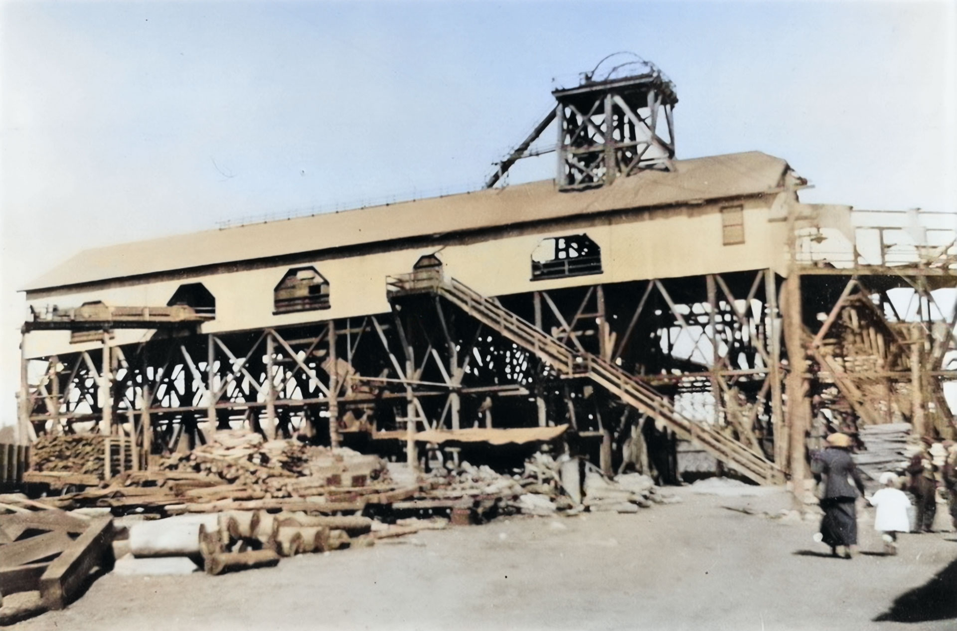
In 1910, the Western Fuel Corporation initiated the construction of the Reserve Mine to exploit an extension of the Douglas coal seam, extending south from Nanaimo. This mine, situated within what is now the Number 3 Nanaimo River Reserve, consisted of two shafts that were sunk to a depth of approximately 900 to 1000 feet. A significant coal seam was discovered at this depth.
The mine was served by a rail line connecting to the Number One mine terminal in downtown Nanaimo, passing through Chase River and Maki Road. To support this mining operation, the company built several substantial trestles and a significant steel bridge over the river. While the mine initially operated successfully, the 1913 Strike brought its activities to a temporary halt. However, operations resumed the following year and continued until the early 1930s, marking a significant chapter in Cedar’s history.
In the heart of Cedar’s rich history lies a tapestry of pioneers and settlers who shaped this picturesque riverside community. The diverse stories of these settlers, entrepreneurs, and miners, along with Cedar’s vibrant community life, create a mosaic of history that endures to this day. Cedar’s past is not just a reflection of its natural beauty but also a testament to the resilience, tenacity, and generosity of the individuals who call it home. It is a heritage worth preserving and cherishing, a legacy that continues to shape the Cedar of today.
Thanks to Tom Teer, for inspiration, photos, information and references.
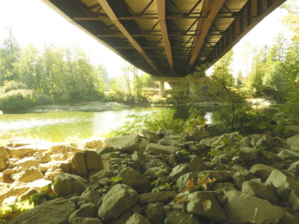
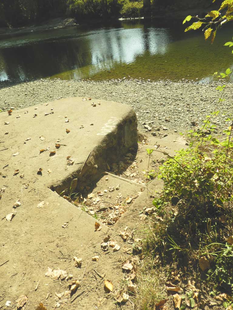
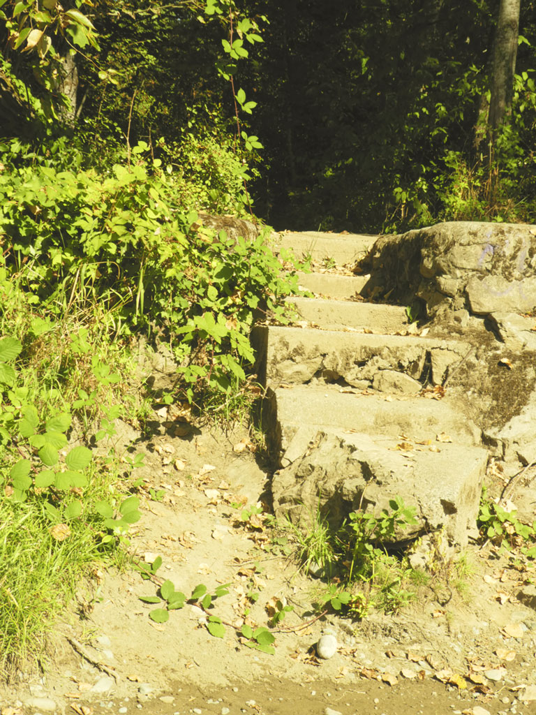
Stovely, Present Day


Sources of Information
Donna-Jean Noddin, Cedar Neighborhood News, Nanaimo Daily Free Press
John Cass, The Way It Was, Nanaimo Daily Free Press
Hazel Galloway, A History of Bright, Cedar, Cranberry and Oyster Districts
Viola Johnson-Cull, Ladysmith New Horizons Historical Society, Chronicle of Ladysmith and District
E. Blanche Norcross, Nanaimo Historical Society, Nanaimo Retrospective – The First Century
Lynne Bowen, Boss Whistle
Helen Tilley, South Wellington Historical Society, South Wellington, Stories From The Past 1880s-1950s
The Provincial Archives
Nanaimo Community Archives
Shari Lindsay, Pacific Spatial Systems, Coal Mine Underground Workings Atlas
Marina Sacht, Take 5 Print and Digital Media – Farms and Folks
Walter Meyer Zu Erpen – Fiddick Family Archives
Diane Dunaway and Consuela Biart – Memories of San Salvador Resort and the Alcorn family
Carol Leynard – for Armishaw references
Steve Young – and Tom Gilchrist – for the house on the hill that wouldn’t stay still
Richard Weighill